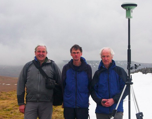

Three British hikers have spent the last four years expanding their hobby of hillwalking to measuring hills that are close to mountain status (mountain status defined as more than 2,000 feet high [609.6 meters]).
“Generally, we look at maps and look for hills that are close to the 609 meter mark and then go and measure it.”
The hikers are:
• John Barnard (retired research chemist from Mold, Wales).
• Graham Jackson (retired research chemist from Cheshire).
• Myrddyn Phillips (retired manager of a printing company from Shrewsbury.
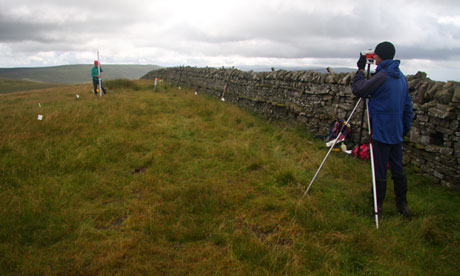
They have measured over 100 hills in England, Scotland, and Wales since 2008. They do this with GPS survey equipment made by Leica and costing £10,000.
They have turned two hills into mountains:
• Recently their work resulted in Thack Moor in the Cumbrian Penines being reclassified from hill to mountain.
• In 2008 their work resulted in Mynydd Graig Goch in Snowdonia being reclassified from from hill to mountain.
Their next target is Illgill Head at Wastwater in the Lake District.
All three of these hills had been measured to be 1,998 high according to Ordnance Surveys.
Although it’s always a possibility, so far no mountain has been downgraded to a hill. Jackson says, “It’s much more fun to add, rather than subtract height. We get a particular pleasure from seeing things promoted rather than relegated to a lower division.”


